Despite military maps showing differently, Ukraine army drove through separatists controlled area
There are many maps published by the Ukraine authorities and others which show which area in Eastern Ukraine is controlled by who.
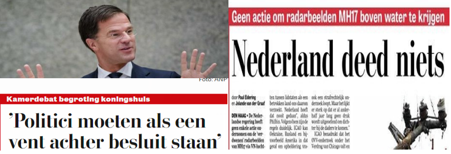
However these maps cannot be used to exclude certain scenario’s. Mister Joustra, chairman of the Dutch Safety Board which only mission is to find the cause of an accident, believed it was his task to state to journalists that the BUK which shot down MH17 was positioned in rebel controlled area.
This was a double-dump of a remark by Mr Joustra. First of all, it is not his employer task to determine who did it. Secondly it could well be Ukraine had positioned a BUK in the area.
Lets have a look at this video below. It was made at July 28 or July 29 2014. We are sure about the date as in the video a Dutch reporter called Jaap van Deurzen can be seen (at 16:18). He only visited the area around the crash site once: around July 28.
A 10+ vehicle Ukrainian army convoy crossed separatists controlled area from Artemivsk to (almost) Saur Mogila.
This trip was recorded on video and can be seen here. Ukraine at war wrote a blogpost showing the locations the convoy passed.
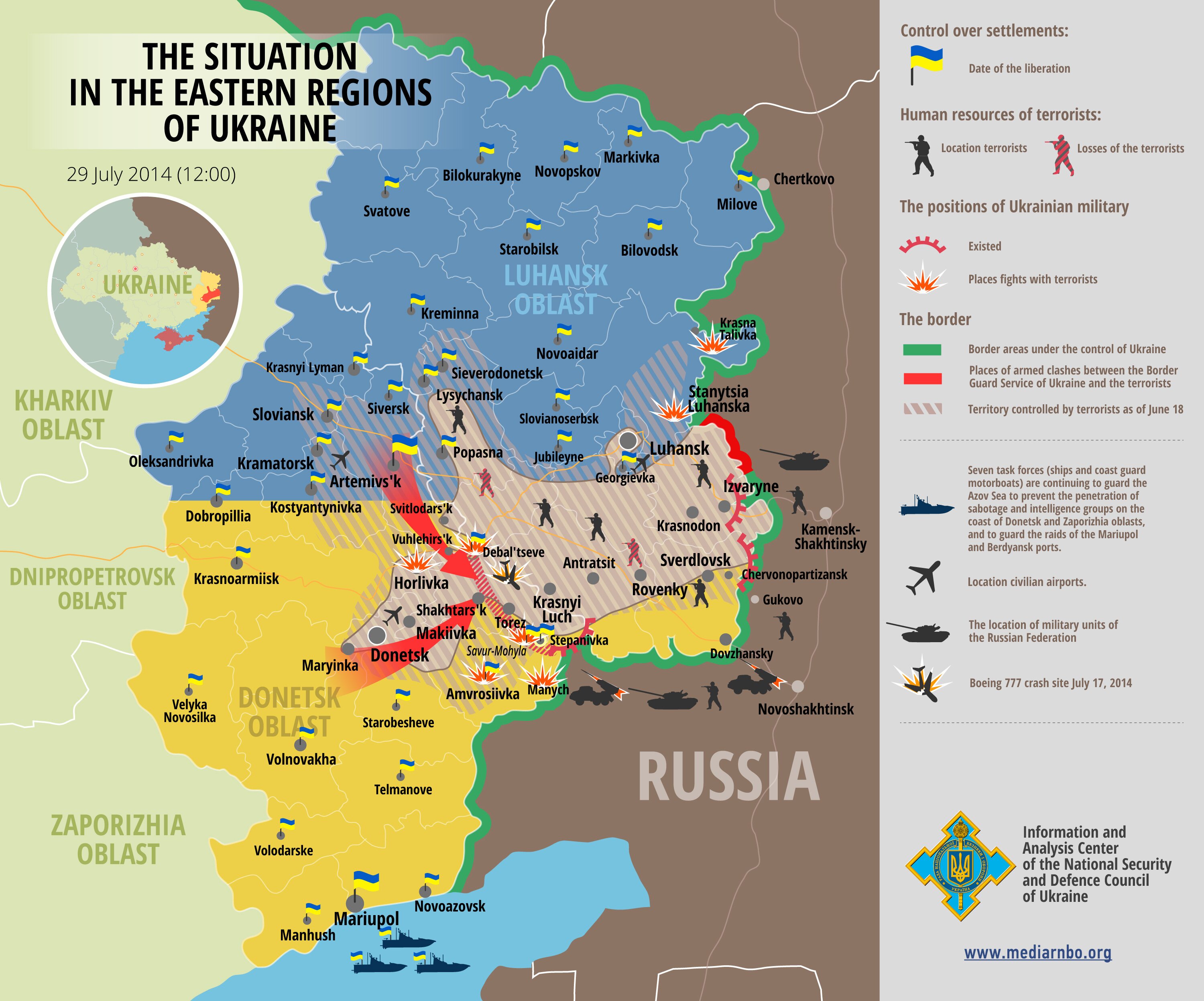
The route of the convoy can be seen in the map below.

The map below shows the situation in Eastern Ukraine. It shows the convoy crossed an area under control of the separatists.
The date this video was made is easy to establish. At 16:17 in the video a man wearing a bulletproof vest can be seen. Also a blonde lady. The man in the bulltproof vest is Dutch reporter Jaap van Deurzen. The lady is his interpreter.

Jaap van Deurzen confirms the date of the convoy to be end of July. My guess either July 27/28. See the RTL Nieuws of July 28. Van Deurzen arrived Ukraine July 26 and left August 5.
dit was inderdaad eind juli!!
— jaapvandeurzen ()
—


That was a well-known daredevil raid using rather fast battle-ready vehicles with an obvious aim to check the possibility to liberate the MH17 crash site or at least ensure access to it. The guys were rather lucky enduring at least one fight that got caught on camera and possibly more off-camera.
Would you imagine anyone trying to move heavy, slow and rather unprotected ‘Buks’ through an enemy territory under such dangerous circumstances?
At the time of crash total number of rebels was approximately 10,000. Assuming uniform distribution you will get a fraction of a rebel per square km. In reality they were concentrated in 4-5 locations. Hence, the whole premise of “rebel controlled territory” is stupid and total invention by Ukrs. They could go anywhere without any resistance till they reach a concentrated force. Plus there was no clear distinguishing marks on units and armor (so many times Ukrs were caught on armor and vehicles with white circles that they later claimed to be solely Russian army circles). So Ukrs could go around for a while pretending to be rebels. Those maps are a hoax and another prove how unprofessional BBC and other western media are for using them without clarification
“so many times Ukrs were caught on armor and vehicles with white circles that they later claimed to be solely Russian army circles”
— Quite the opposite: these were the circles used solely the combined Russian-separatist forces in August-October 2014 or so. They mostly over-painted a blue circle with yellow Russian letters “MC” standing for “Peacekeeping Forces” with those white circles, and in many cases the original sign was still visible through the white paint.
The Ukrainian troops were first seen with the same signs, the white circles, only in November 2014 — as well as with green stripes (not white) on their equipment that have been used only by the Russians/separatists before that.
So Ukrs decided to use markings of “invading army” of Buryats specifically after November 2014. White circles are so smart looking, aren’t they? Fantastic Logic and excuse, Prosto. I think you can do better.
In any case what about the main premise of my post. The concentration of rebel forces against claims of rebel controlled territory.
It’s not “logic and excuse,” it’s a fact. In early November 2014 (or in late October), for some reason I don’t know the Ukrainian forces substantially changed the way of marking their military equipment and began using also marks that had been the trademarks of the invading Russian forces until that time. Saying this, I don’t know if the Russians changed their marking as well at the time.
In any case, the risks of venturing into Russian/separatist-held territories are clearly visible from the video. Would you suggest any side would risk such heavy weapons as a ‘Buk’ or a ‘Msta-S’ and bring them close to the enemy positions where they might be easily lost?